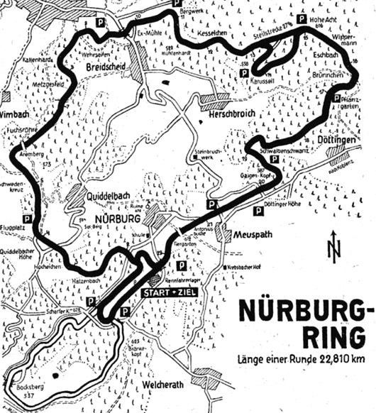
Vintage Nürburgring map (including Südschleife)
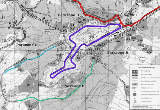
I hope you enjoy looking at this old Nürburgring map. The dark line is the Nordschleife (North Loop), note the Steilstrecke section (above the Karussel) which was used for steep gradient tests. The lighter circuit below is the 7.7 kilometre Südschleife (South Loop) which was lost when the Grand Prix track was redeveloped in the 1980s. Read more below to see a representation of the how the GP track affected the Südschleife. For a brief history, read this website. A more detailed historical account of the Südschleife can be found here.

Red = Nordschleife; Violet = Grand Prix track (1983); Blue = destroyed road; Green = Remaining public road section


